A Journal of our Travels
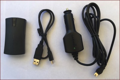
We have a Garmin Nuvi 1450 for turn by turn navigation.
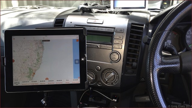
We have installed an iPad running Hema Explorer for moving map display. As it is a Wi-Fi only iPad, a Garmin Glo GPS receiver is used which connects to the iPad via Bluetooth.
The receiver sits on the dash and provides location data to Hema Explorer (and other applications).
The iPad is mounted using a RAM seat mount.
In my Etrex, I use Tracks4Australia maps when travelling in Australia, and New Zealand Open GPS maps for NZ. To download the maps to the GPS from my PC I use Garmin Trip & Waypoint Manager.
For mapping software I use OziExplorer.
I have now started using MacGPS Pro on a Mac for mapping and downloading tracks from my GPS.
The maps I use are Natmaps Raster 250K for Australia, and Fugawi 4M for the rest of the world.
I use the GPS for checking where we are, recording and displaying favourite locations (using waypoints), and for recording our track to be later downloaded into OziExplorer. The Etrex is NOT a navigation GPS unit.